Forest Tower Address and How to Find Camp Adventure
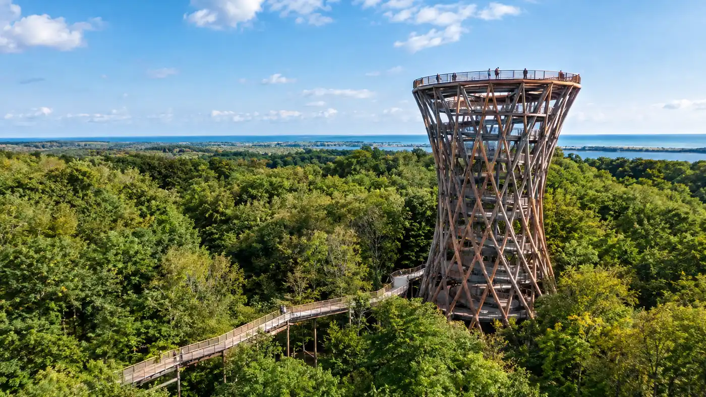
Finding the exact skovtårnet adresse can be surprisingly confusing if you rely on a quick search while driving south from Copenhagen. Look up the landmark online, and you will see it listed under Haslev, Rønnede, and sometimes even Faxe or Næstved. The tower does not sit in a town center. It hides in the quiet beech woods of South Zealand on historic estate grounds, which explains why search results give you four different postal towns for the exact same wooden spiral.
Getting your route right before you set out saves you from ending up on a dead-end tractor track. In this guide, I will share the official postal location, precise GPS coordinates, transit routes, and practical driving tips. Whether you are coming by car down the E47 motorway or piecing together rural regional buses, here is everything you need to navigate straight to the forest without hassle.
Book your forest tower denmark experience:
Official Skovtårnet Adresse and Exact Coordinates
The official address recognized by municipal registries and Danish postal delivery is:
Camp Adventure
Denderupvej 19
4690 Haslev
Denmark
Denderupvej is a long, winding rural road cutting through fields and stands of old forest. While the physical driveway leads off Denderupvej, you might also spot signs pointing toward a dedicated access lane dubbed skovtårnsvej on local trail maps. Do not let that throw you off. The entry gate for cars, buses, and cyclists sits squarely on Denderupvej.
Note: Some older satnav systems try to route vehicles down private dirt roads on the estate grounds near Gisselfeldvej. Always stay on paved asphalt until you see the wooden Camp Adventure signs guiding you into the gravel lots.
If you prefer punching direct coordinates into your phone or car navigation system rather than typing out Danish street names, use these:
Latitude: 55.2574° N
Longitude: 11.9806° E
Using coordinates prevents mapping software from dumping you at the wrong side of the forest parcel. The woodland covers hundreds of hectares, so ending up two kilometers away on a farm track is a common mistake for first-time visitors.
Hvor Ligger Skovtårnet? Understanding the Regional Geography
People often ask me, hvor ligger skovtårnet when they see it tagged in completely different municipalities on social media. The confusion makes total sense. Camp adventure adresse belongs administratively to Faxe Municipality, yet the closest railway town is Haslev, while the nearest motorway exit is Rønnede. To complicate things further, plenty of visitors call it skovtårnet næstved because Næstved is the largest commercial city in the region, sitting just 20 kilometers to the west.
The forest itself belongs to Gisselfeld Kloster, one of Denmark's oldest and grandest private estates. You will frequently hear locals refer to the structure as gisselfeld tårn or camp adventure gisselfeld. Historically, these woods served as private hunting and timber reserves for the monastery estate. Today, Camp Adventure leases the parcel, building an eco-tourism hub right into the canopy.
| Origin Point | Distance | Typical Drive Time | Direct Highway Route |
|---|---|---|---|
| Copenhagen Central | 73 km | 50-55 mins | E47 / E55 Southbound |
| Køge | 38 km | 30 mins | E47 Southbound |
| Næstved | 21 km | 22 mins | Route 54 Eastbound |
| Haslev Station | 9 km | 11 mins | Denderupvej South |
| Rønnede Town | 5 km | 6 mins | Route 54 to Denderupvej |
If you see signs or online posts mentioning tårn i næstved, udkigstårn næstved, or trætårn i næstved, they almost certainly refer to this exact spot. There is no massive wooden observation deck inside Næstved city limits. Skovtårn rønnede, haslev tårn, and rønnede tårn are merely different local names for the same attraction.
Driving Directions to Camp Adventure Rønnede and Haslev
Driving is by far the easiest way to reach the grounds. The journey from Copenhagen takes under an hour outside the morning commute. You head south on the E20/E47 motorway, continuing down the E47/E55 toward Rødby and Gedser. Keep an eye out for Exit 37, marked for Rønnede and Route 54.
Once you exit the highway at Rønnede, take Route 54 heading west toward Næstved. After roughly 3 kilometers, you will reach a roundabout where signs direct you right onto Denderupvej. From there, the road narrows and passes between open fields and deep thickets. Drive carefully around the bends because farm equipment and deer frequent this stretch.
Pro tip: Automated parking cameras scan your license plate at the main gate, so remember to pay via the EasyPark mobile app or at the self-service payment screens in the reception barn before you leave.
Parking costs 65 DKK per vehicle for the full day. The gravel lots accommodate several hundred cars, but during sunny summer weekends, spaces close to the entrance fill up by 11:00. Attendants usually direct traffic into secondary grass pastures on peak holiday dates.
Book your forest tower denmark experience:
Reaching Skovtårnet Haslev via Public Transportation
You can manage the trip without a rental car, though it takes a little patience. Public transit runs reliably across Zealand, but rural bus schedules require careful timing. If you are starting out from the capital, our detailed guide on visiting the Forest Tower from Copenhagen breaks down the regional train ticketing in full depth.
The standard transit journey breaks into two main legs:
- The Regional Train: take the DSB train from Copenhagen Central Station directly to Haslev Station or Næstved Station, which takes about 45 to 55 minutes depending on the departure.
- The Connecting Bus: catch regional Bus 630R from Haslev Station toward Næstved, getting off at the stop named Denderup Vænge or Ny Ulsevej.
- The Final Footpath: walk roughly 1.3 kilometers along the marked roadside verge from the bus stop directly into the main Camp Adventure entryway.
- Alternative Taxi Ride: hire a local taxi directly outside Haslev Station, which usually costs around 180 DKK one way and saves you waiting for the hourly bus.
Bus 630R runs roughly once an hour on weekdays. On weekends and bank holidays, departures drop to every two hours. Check the Danish journey planner website, Rejseplanen, the night before you travel so you do not find yourself stranded at a quiet rural bus shelter with an hour to kill.
Arriving on Site: Navigating Camp Adventure Locations and Trails
Pulling into the gravel car park does not put you right at the base of the tower. Camp Adventure is an expansive outdoor park spanning over 30 hectares. When you park, you find yourself at the main courtyard complex featuring timber barn buildings, clean restrooms, street food vendors, and a ticket check-in desk.
The reception staff will check your digital admission voucher. If you need details on pricing tiers or peak-season entry schedules before buying, review the breakdown for Forest Tower tickets, prices and opening hours to pick the right arrival window.
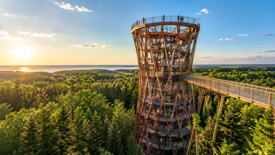
The actual tower sits deep in the beech forest. Reaching it requires a pleasant 1.2-kilometer stroll along a wide wooden boardwalk. This elevated pathway winds gently through valleys, past small streams, and around century-old trees. It takes most people 15 to 20 minutes to reach the foot of the tower from the ticket check.
- Accessibility features: the boardwalk and the entire tower ramp are completely step-free, making them accessible for sturdy strollers and manual wheelchairs.
- Activity branches: side paths lead away from the main walkway toward the treetop zip-lines at the climbing park and the glamping yurt villages.
- Weather conditions: the wooden planks can turn slippery after rain or morning frost, so wear sensible shoes with rubber soles rather than smooth city boots.
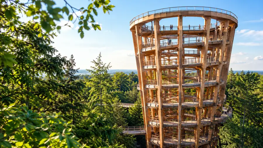
The gradual approach through the trees builds anticipation. You cannot even see the hourglass shape of the tower until you round the final bend on the forest floor. The architecture opens up suddenly against the sky, towering 45 meters above the forest floor.
Frequently Asked Questions about skovtårnet adresse
What is the correct GPS address for the Forest Tower?
The official postal address is Denderupvej 19, 4690 Haslev. For satellite navigation devices, enter the coordinates 55.2574 N, 11.9806 E to reach the entrance gates directly.
Is Camp Adventure located in Næstved or Haslev?
The park is physically in Faxe Municipality near the town of Haslev. However, because it sits just 20 kilometers east of Næstved, many guidebooks and tourists refer to it as tårn ved næstved.
Can I take an Uber or taxi to the tower from Copenhagen?
Uber does not operate in Denmark. You can book standard Danish taxis, but a one-way trip from central Copenhagen will easily run upwards of 1,400 DKK, making a rental car or regional train far more practical.
How far is the walk from the car park to the tower structure?
It is roughly 1.2 kilometers from the reception courtyard to the base of the tower. Plan on an easy 15-minute walk along the wooden boardwalk before you begin climbing the spiral ramp.
Quick Reference
- Address: Denderupvej 19, 4690 Haslev
- Coordinates: 55.2574° N, 11.9806° E
- Highway: E47 / E55, Exit 37 Rønnede
- Parking: 65 DKK per day (EasyPark app)
- Boardwalk to tower: 1.2 km (15-20 mins)
Book your forest tower denmark experience:
Before You Hit the Road
Getting your bearings before you set out makes a day trip to Camp Adventure completely relaxed. Punch Denderupvej 19 into your mapping app, keep to the highway until Exit 37, and follow the simple timber signage through the Gisselfeld woods. Bring comfortable walking shoes, double-check your bus connections if you are using public transit, and give yourself plenty of time to enjoy the calm forest walk on your way up into the canopy.
Read more about forest tower denmark.